_0003.jpg)
If you’re shopping in Northeast Florida, “flood zone” comes up fast — usually right after you fall in love with a porch, a backyard, or a commute that finally feels doable. The tricky part is that water risk here isn’t one single thing. In some areas it’s rivers and creeks. In others it’s drainage and street ponding after summer storms. Near the coast, tide timing can change how quickly stormwater clears. The good news: you can check the basics in minutes, and you can sanity-check the day-to-day reality without turning the home search into a stress project.
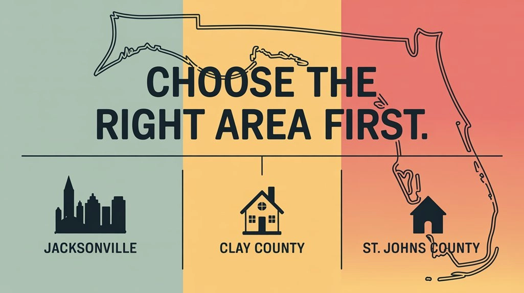
This guide is written for homebuyers looking across the usual Northeast Florida footprint — Duval, St. Johns, Clay, Nassau — and anyone cross-shopping nearby areas. This is Northeast Florida real estate from the practical angle: what the maps say, what the streets do after heavy rain, and what you should verify before you commit. It’s lifestyle-first: the goal is to help you understand what daily life looks like after heavy rain, high tide, and hurricane season, and how to verify what matters before you get emotionally invested.
Quick result you want to walk away with
- A saved FEMA map snapshot for the address (zone + map panel).
- A county GIS check for flood layers and nearby water features.
- An evacuation zone check (different from FEMA flood zone).
- A short street reality check: drainage, low points, and how your route behaves in summer storms.
Tools by county (quick links)
Duval (Jacksonville)
St. Johns
Clay
Nassau
If you only do one thing today, run the FEMA map check and save a screenshot. Then use the county tool for the address to add local context.
Quick glossary (the terms you’ll actually see)
- FIRMette: a downloadable map snippet from FEMA’s flood map system for a specific area/address. It’s handy because you can save it and compare multiple homes without re-running everything later.
- BFE (Base Flood Elevation): a mapped reference elevation used in some flood zones (often AE). Homebuyers usually care because it can affect how a flood insurance policy is priced and how an elevation certificate is interpreted.
- Zone X: commonly treated as lower mapped flood hazard. It can still have drainage or street ponding issues, so it’s best read as “not flagged as high hazard on the map,” not “water can’t be a problem here.”
What a Flood Zone Means in Northeast Florida
A flood zone is a map-based category tied to flood insurance and certain lender requirements. It’s FEMA’s way of mapping flood hazard areas on official flood maps. It’s not a guarantee that a property will flood, and it’s not a guarantee that a property outside a mapped zone will never have water issues.
In Northeast Florida, that nuance matters because many of the everyday headaches homebuyers actually notice are about drainage and street ponding after heavy rain — and those can show up well outside the headline zones. Across Duval, St. Johns, Clay, and Nassau, you’ll hear the same pattern: one block drains fine, the next one holds water, and it’s often more about low points and stormwater capacity than about a big river being nearby. Flood-zone context is one of those Northeast Florida real estate checks that pays off early, because it affects both monthly costs and peace of mind.
Start Here: Check the FEMA Flood Map by Address
The cleanest official baseline is FEMA’s Flood Map Service Center. You plug in an address and pull the map panel for that location. If you’re doing this while browsing listings, treat it like a consistent routine — the same way you’d confirm school zones or commuting routes.
FEMA address check (5 minutes)
- Open the FEMA Flood Map Service Center: msc.fema.gov/portal/search
- Enter the full address and run the search.
- Note the flood zone label and the map panel information.
- Save a screenshot (or download a FIRMette if available) so you can compare properties later without re-running the search.
- Write down what you saw in one line: “Zone ___, panel ___, map date ___.”
Don’t overthink the first pass. You’re building a clean baseline you can reference later — especially if you’re comparing multiple neighborhoods in the same search week. It keeps your head clear, and it prevents the “I think that one was the higher-risk one…” confusion.
Use County Map Tools for Local Context
FEMA gives the official baseline, but county GIS tools are where you pick up useful local context quickly: parcel outlines, nearby drainage features, and other layers that affect day-to-day reality. If you’re the kind of homebuyer who likes a verification path you can repeat, this is where Northeast Florida starts to feel manageable.
St. Johns County: Flood Zone Viewer and iMap layers
St. Johns County makes this straightforward: click a parcel and it returns flood zone information. If you’re cross-shopping coastal and near-coastal areas, it’s also helpful that their flood resources point to additional map layers homebuyers care about, like evacuation routes and storm surge-related layers.
- Flood Zone Viewer: gis.sjcfl.us/floodviewer
- Floodplain facts and related map layers: sjcfl.us/flood-facts
Duval County: Duval Property Map and evacuation zone search
Duval County (Jacksonville) is a mix of coastal, inland, and river/creek realities, so the map tools help you separate “near water” from “drainage low spot” quickly. This is also where a house can look fine on paper, but the route you drive every day tells a different story after a heavy afternoon storm.
- Duval Property Map: maps.coj.net/duvalproperty
- Evacuation Zone Search (by address): maps.coj.net/evsearch
Clay County: Flood map resources for address-level checking
Clay County is a common cross-shop for homebuyers who want more space and a quieter daily pace, while still staying connected to Jacksonville through routes people actually use, like Blanding Boulevard (SR 21), US-17, and I-295 connections depending on where you’re headed.
Clay’s flood resources are also a good reminder that maps can be updated, which is why saving what you checked (zone, panel, map date) is part of a smart routine.
Clay County flood map resources: claycountygov.com flood maps
If you hear about map changes, the practical move is simple: save what you checked (zone, panel, date) and ask whether any pending FEMA map updates are being discussed for that area. An update can change insurance conversations for future buyers even if your day-to-day drainage experience stays the same.
Nassau County: Flood map service hub
Nassau is another frequent cross-shop: more space, different price points, and a different daily drive if you’re commuting toward Jacksonville. The county flood map hub is a practical stop for quick verification: Nassau County Flood Map Service Hub
Flood Zone vs Evacuation Zone: Not the Same Thing
This is one of the most common misunderstandings in Northeast Florida: FEMA flood zones relate to mapped flood hazards and insurance/lender conversations. Evacuation zones relate to storm surge risk and emergency planning.
In Duval County, you can check your evacuation zone by address using Jacksonville’s tool (linked above). If you want the statewide context for how evacuation zones work, Florida’s disaster preparedness site keeps it clear: floridadisaster.org/knowyourzone
What Homebuyers Notice After Heavy Rain and High Tide
Here’s the lived-in reality: many Northeast Florida water problems show up on normal weekdays — not just during hurricanes. That’s why it helps to check both the maps and the routine: the streets you drive, the places you park, and the low points you pass without thinking on sunny days.
Street-level signs homebuyers pay attention to
- Standing water after a normal summer downpour. Not a named storm — just a heavy afternoon rain. If the street holds water for hours, you want to know why.
- Drainage ditches and culverts that look overwhelmed or clogged. In parts of Northeast Florida, the difference between “fine” and “annoying” can be a ditch that stays clear or one that backs up.
- Low points you drive through every day. The dip you barely notice on a dry day can become the spot everyone slows down for after a storm.
- Coastal backflow during high tides in older areas. Near-coastal drainage can behave differently when tides are high and stormwater can’t clear as quickly.
- Recurring nuisance spots. Instead of relying on reputation, look for patterns tied to specific intersections or outfalls. In Northeast Florida, the same handful of low points tend to come up repeatedly in storm seasons.
If you’re shopping near the coast, it helps to remember one simple reality: sometimes stormwater systems need gravity to do their job. When tides are high, water doesn’t always leave the system as easily. St. Augustine’s tide check valve work is a practical example of how tide can affect drainage timing. (City information here: citystaug.com)
The only reason to know this as a homebuyer is simple: in some coastal and near-coastal pockets, the same rain event can behave differently depending on tide timing. That’s why map checks and street reality checks work best together.
If you are looking near the Atlantic side of St. Johns County or around older drainage areas closer to the Intracoastal, tide timing can be part of the practical reality check.
Zones You’ll See Most Often (A, AE, VE, X) and What Changes for a Homebuyer
You’ll usually see variations of these four in Northeast Florida searches:
- Zone A / AE: Special Flood Hazard Area categories where flood insurance is commonly required by lenders for certain mortgages. “AE” often means base flood elevations are established on the map.
- Zone VE: Coastal high-hazard areas where wave action is a factor. This is more common in certain coastal exposures and can change insurance conversations.
- Zone X: Often treated as lower mapped risk, but it does not mean “no water issues.” Plenty of drainage and street ponding concerns live outside mapped high-risk zones.
One important detail: a lender may require flood insurance in certain mapped zones, but outside those zones it becomes a personal risk choice. Many Northeast Florida homebuyers still price it out anyway, because “not required” does not always mean “no water issues,” especially in spots where street drainage is the real story.
If you want the official definitions tied to the maps you’re looking at, FEMA’s flood map resources are the right reference point: fema.gov/flood-maps
The 10-Minute Property Flood Check
If you’re comparing a handful of homes, a repeatable check keeps your head clear. Here’s a routine many careful homebuyers use:
- FEMA first: run the address on the FEMA Flood Map Service Center and save a screenshot.
- County GIS second: confirm the parcel and turn on flood-related layers where available.
Tip: most county GIS sites have a “Layers” or “Map Contents” button. Turn on flood or floodplain layers, then click the parcel.
- Evacuation zone check: especially if you’re anywhere that feels close to the water or you’re comparing coastal vs inland.
- Street reality: look at the immediate block and the usual drive-outs (school, grocery, highway access). You’re checking whether the daily routine is likely to get annoying during summer storms.
- Flood history reality check: ask for specifics (water entry, yard drainage work, prior insurance claims if disclosed) and scan local public updates and neighborhood discussions for repeated patterns tied to the same streets or intersections. You are looking for recurring issues, not one-off storm stories.
If you’re comparing listings, keep one notes line for each address (zone, evacuation zone if relevant, and one street-level observation). It makes it easier to shortlist homes that feel like a clean fit before you spend time going deep on the details.
What to Look For During a Showing When Water Risk Is a Question
You don’t need special equipment for this. You’re looking for clues that the house and lot handle water like a normal Florida property should, especially during the summer storm stretch.
These checks are less about perfection and more about avoiding the expensive surprises that show up after the first real summer storm.
- Downspouts and grading: look for downspouts dumping right at the foundation and yard slopes that push water toward the house.
- Garage and exterior walls: check the lower 12–18 inches for staining, patchy paint, or baseboard replacements that look newer than the rest.
- HVAC and electrical placement: note whether key equipment is elevated or sitting low where water would collect first.
- Lot low points: walk the yard edges and side yards; bowl spots are often obvious even on a dry day.
- Street drains: find the closest inlet; if it’s packed with debris or the curb line dips hard nearby, that’s useful context for heavy rain days.
Questions to Ask When Flood Risk Might Affect Your Decision
You don’t have to interrogate anyone. A calm, practical set of questions usually gets you better answers — and it keeps the home search feeling steady.
- Has water ever entered the house or garage? If yes, was it rainfall runoff, plumbing, or a known event?
- Any drainage work done on the lot? Grading changes, French drains, downspout routing, sump systems — the “what was fixed and why” matters.
- Do you have an elevation certificate? Not every property has one available, but when it exists, it can clarify how the structure sits relative to mapped elevations.
- How does the street behave after heavy rain? You’re listening for specifics: “water crosses the road” vs “it’s fine in an hour.”
If the address is in a higher-risk mapped zone, it can also change the closing checklist. Some loans require proof of flood insurance before final approval, and if an elevation certificate is involved, it can affect how the policy is priced. It’s not a reason to worry — it just means you want to confirm requirements early so you don’t create last-week friction.
Coastal rules that can affect future projects near the ocean
If the home you’re checking is near the ocean, the “what it means” part is not only insurance. Future exterior projects can have extra rules in some coastal areas, which is worth knowing early if you’re the type who buys with a five-to-ten-year plan in mind. Florida DEP explains how to locate the Coastal Construction Control Line (CCCL) here: Locate the CCCL (Florida DEP)
Common Flood Zone Trade-Offs in Northeast Florida Real Estate
Most homebuyers here are balancing the same real trade-offs:
- Near-water lifestyle vs extra homework. Water proximity can be a daily-life win, but it may add insurance conversations and extra verification steps.
- Older neighborhoods vs newer stormwater design. Mature trees and established streets can be the charm, but drainage patterns can be uneven block-by-block.
- Inland convenience vs surprise low spots. A house can be “not near water” and still deal with ponding if the lot sits at the wrong point on the street.
One practical real estate note: flood-zone clarity and documented mitigation work can matter at resale, because future homebuyers and lenders often repeat the same verification steps you’re doing now.
The homebuying experience stays a lot more positive when you treat flood checks like any other smart verification step. You’re not trying to predict every storm. You’re confirming what’s true about this address, this street, and the routines you’ll live inside — school mornings, commutes, and quick errands — and whether the property fits the way you actually want to live.
FAQ: Flood zones and property checks in Northeast Florida
Can a home be in Zone X and still have water problems?
Yes. Zone X generally indicates lower mapped flood hazard, but it does not guarantee the street drains well or that a low spot won’t hold water after heavy rain. That’s why pairing FEMA with county GIS and a simple street-level check tends to give homebuyers a more realistic picture.
If a property is in a higher-risk zone, does that mean I shouldn’t buy it?
Not automatically. In Northeast Florida, two properties in the same mapped zone can behave very differently based on elevation, drainage, and how water moves across the lot and street. The better approach is: confirm the map category, understand what that changes (insurance and lender requirements), and then verify the day-to-day reality.
What’s the fastest official way to check a flood zone by address?
FEMA’s Flood Map Service Center is the standard starting point: msc.fema.gov/portal/search. Save a screenshot of the result so you can compare homes later without re-running the search.
How do I check flood zones in St. Johns County quickly?
Use the St. Johns County Flood Zone Viewer and click the parcel: gis.sjcfl.us/floodviewer. If you want extra layers beyond the zone label, St. Johns also points homebuyers toward map layers via their flood resources: sjcfl.us/flood-facts.
What’s the difference between flood zones and evacuation zones in Duval County?
Flood zones are FEMA map categories tied to flood hazards and insurance. Evacuation zones are used for storm surge planning. In Duval County, you can check evacuation zones by address here: maps.coj.net/evsearch.
A neighborly final note
Flood zones feel intimidating until you treat them like any other smart homebuyer check. You’re not trying to predict the future. You’re confirming what’s true about this address, this street, and the routines you’ll live inside — and you’re doing it early enough that the process stays smooth. Do the map checks, do one quick street reality pass, and you’ll usually know whether a property feels like an easy “yes” or a “not this one.”
_0003.jpg)
.png)