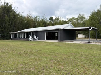
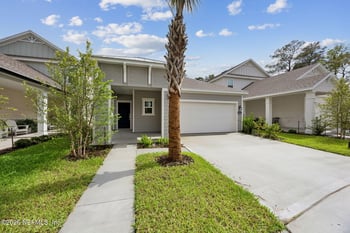
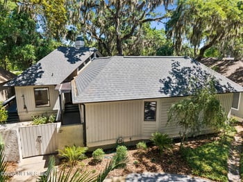
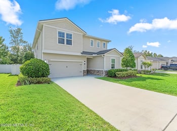
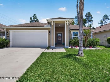
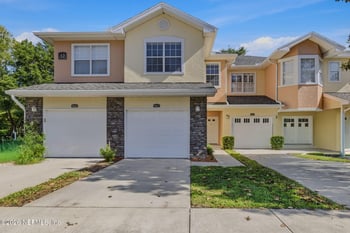
Open: Sat 12:00 PM - 2:00 PM

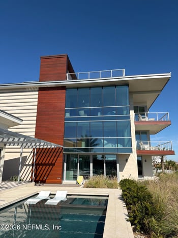
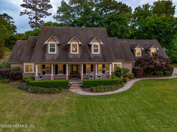
$476,000
Active
3
Beds
3
Baths
1718
Sqft
--
Acres
2158 Hibiscus Ct, Fernandina Beach, FL 32034
MLS#: 2147112
_0001.jpg)
If you’re house-hunting or renting in Fernandina Beach and you’re wondering whether you’d actually use Egans Creek Greenway weekly, this is the day-to-day view: where you enter, where you park, what “busy” tends to look like, and what the path feels like once you’re on it.
This isn’t a tourism list. It’s the practical stuff that changes your routine: which entrance you’ll default to, whether a stroller is comfortable on the sections you’ll actually use, and what you notice when you walk it more than once. If you’re comparing Fernandina Beach real estate by daily-life fit, it helps to browse Fernandina Beach homes for sale with a specific Greenway access point in mind.
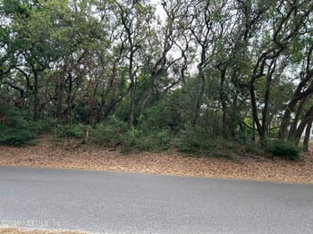
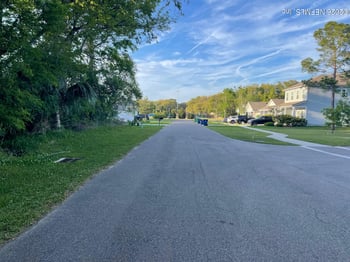
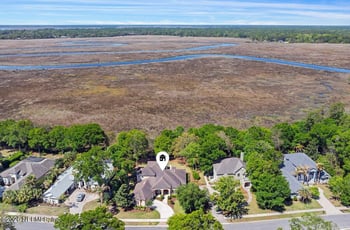
Egans Creek Greenway runs north–south along Egans Creek through the middle of Fernandina Beach as a protected, passive-use nature corridor. In everyday terms, it’s a signed Greenway trail system with multiple entrances that lets you get off neighborhood streets and into marsh-and-woods scenery without leaving town.
The north side puts you closer to Atlantic Avenue and the Atlantic Recreation Center area. Farther south, access points pull you toward the Sadler Road side (behind the Residence Inn), which is a common “jump in for a shorter walk or ride” start if you’re staying or living closer to the beach/Sadler/A1A side.
If you’re trying to place the Greenway into your overall Fernandina routine—downtown Centre Street errands, beach access, and commute routes—this guide keeps that context practical: Living in Fernandina Beach, FL: Downtown (Centre Street), Beach Access, and Commute Routes.
For official trailhead locations and current access notes, the cleanest authority reference is the City of Fernandina Beach’s Egans Creek Greenway page.
This is the most straightforward “park, get moving” start, especially if you’re bringing kids. It’s also where you’ll find the Nature Pavilion area and a restroom, which is a real quality-of-life detail once the Greenway becomes something you do weekly.
Jasmine Street is the quick neighborhood access: easy to pop in for a short loop or an out-and-back. If you live nearby, this is the kind of entrance that makes the Greenway feel like part of your normal walk instead of a destination you have to plan.
If you like stepping onto the trail system from a quieter residential edge, Citrona Drive is worth knowing. The Beech and Hickory extensions are useful landmarks here because they cross the creek on bridges—once you’ve used the Greenway a few times, those crossings become “turnaround” markers.
This is a common “I’ve got 30–60 minutes” start point. It’s convenient from the south end of town, and it works well if you want a shorter outing without hunting for a bigger lot. There’s also a raised boardwalk segment associated with this end, which is one of the most recognizable built features on the Greenway.
Where people park
In practice, most regular users end up with one “default” spot based on where they live and what kind of outing they’re doing:
The Greenway usually doesn’t feel crowded the way a beach walkway can. “Busy” shows up first in parking and in shared-use pinch points—narrow bridges, boardwalk segments, and places where walkers, dogs, and bikes are all moving through the same short stretch. If you want the calmest experience, weekday mornings and late afternoons tend to feel easier. If you’re testing this as a weekly habit, try it once on a weekday and once on a weekend so you understand what your most likely walk time feels like.
Arriving with kids, a stroller, or a bike
Egans Creek Greenway is a trail system with natural segments and built features. You’ll see boardwalks and bridges in places, and other sections feel more like maintained natural trail. After rain, some low areas can feel softer or hold water longer than a paved path would, which matters if your routine includes a stroller or you want an easy, consistent ride.
Some stretches feel open near marsh views, and other sections feel more sheltered. That’s one reason people develop a preference for certain entrances—your start point changes how much of your walk is shaded versus sun-exposed, especially in warmer months.
This is a wetlands corridor, so the scenery is marsh and water edges, with frequent bird activity. If birdwatching is part of why you’d use this weekly, Egans Creek Greenway is listed on the Great Florida Birding & Wildlife Trail. Even if you’re not carrying binoculars, it’s the kind of place where you naturally slow down for a minute at a bridge or a viewing spot.
Most regular users don’t treat the Greenway like one single end-to-end route. They treat it like a flexible routine: park, walk until the scenery changes, turn around—or link a couple segments into a loop. If you’re relocating, the best way to understand this quickly is to try two starts: one from the Atlantic Avenue side and one from the Sadler side. They feel different in day-to-day use.
In real life, this tends to work best for people who want nature in the middle of town, not a fast training route.
The Greenway becomes a habit when it connects cleanly to the rest of your day. North-side users often pair a walk with everyday errands around town. South-side users often treat the Sadler-side access as a quick outdoor reset that doesn’t require beach parking or sand.
If your routine includes downtown, Centre Street is the main “errands and evening walk” area people mean when they say “downtown Fernandina.” For the broader daily-life context—Centre Street, beach access, and commute routes—this guide stays practical: Living in Fernandina Beach, FL: Downtown (Centre Street), Beach Access, and Commute Routes.
Being near marsh scenery doesn’t automatically mean a property has flood insurance implications—but it does mean you should verify by address early.
If you’re moving from out of state, it’s easy to overestimate how often you’ll drive to something “nice” and underestimate how often you’ll use what’s close. For a broader decision framework that stays practical, start with Moving to Northeast Florida: What to Know Before You Choose a Home.
If you’re narrowing down Fernandina Beach real estate options, the best next step is simple: pick the entrance you’d actually use, then test “getting there” from a couple candidate areas. When the Greenway becomes a weekly habit, it’s usually because access is easy.
Ready to cross-shop? Start with Fernandina Beach homes for sale, then use the community list to compare walkability to your preferred Greenway access point.