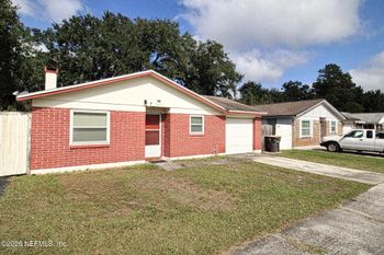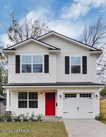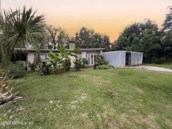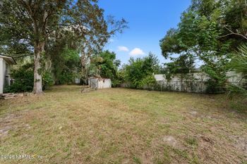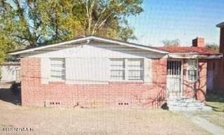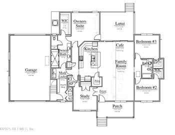

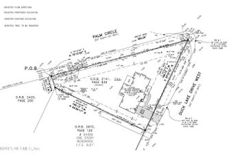
$475,000
Active
3
Beds
3
Baths
2099
Sqft
--
Acres
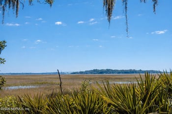
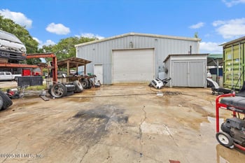
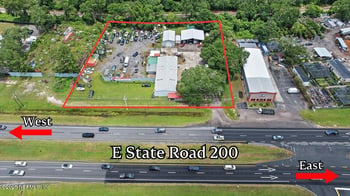
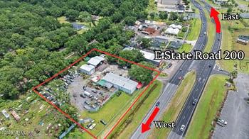
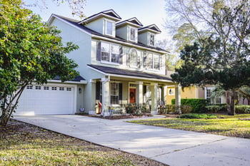
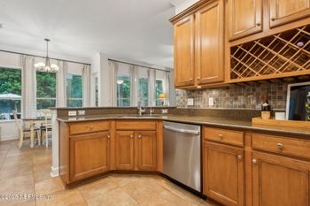
94300 Duck Lake Dr, Fernandina Beach, FL 32034
MLS#: 2116944




A home near Centre Street can put dinner and the Amelia River waterfront within walking distance. A home near an Atlantic beach entrance can put the sand closer, but downtown may be a drive. Both are island living; they are not the same daily routine.
Fernandina Beach sits on Amelia Island, but the city limits do not cover every island property. Historic downtown, the beachfront along Fletcher Avenue, and homes nearer Atlantic Avenue, Citrona Drive or Sadler Road put different places within easy reach. Neither an island address nor a Fernandina Beach listing label tells you which rules or school assignment apply to a specific home.
This guide follows the choices that change a week: walking downtown, reaching a public beach, using Fort Clinch or Egans Creek, traveling to Jacksonville, and budgeting for coastal ownership. To see available homes, browse Fernandina Beach homes for sale and Amelia Island homes for sale. These searches group properties by listing labels; they cannot confirm a home's city limits or assigned schools.
Picture a weekday, not a vacation Saturday. Is the trip you most want to simplify dinner on Centre Street, a quick beach walk, or the school-and-grocery loop? Those three routines can point you toward different parts of Amelia Island.
As of October 26, 2026, the City still operates paid downtown parking, but it has announced November 18, 2026 as the program’s final day. Walking convenience and parking availability will still matter after that transition.
Nassau County school assignment depends on the residence. The district’s current zone document and controlled open enrollment serve different purposes; a transfer also depends on eligibility and capacity.
For a broader island-versus-mainland comparison, see Moving to Northeast Florida. Here, the first useful contrast is downtown: arriving on foot changes the experience before you even reach Centre Street.
From a home within a comfortable walk of historic Centre Street, a weeknight dinner might end with a stroll along the Amelia River instead of another drive. From elsewhere on the island, the same evening begins with finding legal parking. The waterfront at the end of Centre Street faces the river; reaching the Atlantic beach is a separate trip.
What walking distance can change
Driving downtown brings a time-sensitive wrinkle. As of October 26, 2026, the City’s paid parking program is still operating, but officials have announced November 18, 2026 as its final day, following the August election and City Commission action. The rates and enforcement hours below describe the current program, not a permanent cost of visiting Centre Street.
The posted non-permit rate is $2 per hour plus fees and taxes, with the first 20 minutes free each day. City permit allowances include four free daily hours on the street or eight in surface lots. The area extends from Ash to Alachua streets and Front to 8th streets, plus designated lots. Enforcement is Monday–Saturday, 10 a.m.–8 p.m., and Sunday, 1–6 p.m. These terms can change after the announced end of the program.
Removing a parking charge would not create an open space in front of a business. Try the walk from a prospective home, or drive downtown at the hour you would normally go. An ordinary evening and a busy event period can also feel different; if traffic, lighting or nearby activity concerns you, check the particular block at both times.
If an older downtown house appeals to you because you plan to change its exterior, check whether that address is in a City historic district. Location can affect both the daily routine and what alterations are allowed after purchase.
Centre Street brings you to the Amelia River, but an Atlantic beach day takes you to a different edge of the island. A home that looks close to the shore may be a short walk from a public path — or a drive from the nearest entrance with parking. Find the actual access point first, especially if you will carry beach gear or need an accessible route.
City source: Parks & Beaches
The City beach-access list distinguishes public entrances with parking from those without it and details accessible approaches. Beach wheelchairs may be reserved through the Atlantic Recreation Center, subject to availability and service conditions. An accessible entry does not guarantee that every part of the route or stretch of sand works for a particular visitor; confirm the complete approach for your needs.
City beach accesses are posted closed midnight to 5 a.m. That is a City access rule, not a blanket claim about every beach on Amelia Island. A public path also does not authorize parking on private property beside it.
Nassau County separately lists Peters Point, Burney Park and Scott Road among its beachfront facilities and sets rules for unincorporated stretches of beach. County-managed access and City accesses are not interchangeable. In particular, pedestrian access does not mean vehicles may be driven onto the sand wherever there is an entrance.
County source: Beach Front Parks and county beach rules
For a buyer who wants a 30-minute beach stop after work, a no-parking street entrance may be ideal on foot and inconvenient by car. For beach chairs, small children or mobility equipment, facilities and the approach matter more. Try the entrance from the actual home on a weekday and at the weekend time you expect to use it; neither visit proves that parking will always be available.
Another shoreline outing starts at Fort Clinch State Park, 2601 Atlantic Avenue. You might go for a trail walk, a beach stop or a tour of the historic fort, but an hour after work gives you different options from a weekend outing with guests.
The park opens at 8 a.m. and closes at sunset. The fort itself is open 9 a.m.–5 p.m., and its visitor center closes at 4:30 p.m. An evening trail or beach visit may be possible during longer daylight hours; a fort tour needs an earlier arrival. Sunset changes with the season, so “close to the park” is not the same as “usable after my shift.”
Park admission is listed at $6 per vehicle with two to eight occupants, $4 for a single occupant and $2 for pedestrians or bicyclists. Fort entry adds $2.50 per person. Check current charges and the day’s operating conditions before visiting.
If Fort Clinch is a reason to buy nearby, test the trip at your real available hour. It is a different recreational choice from a public street beach access: you are entering a state park, following park hours and paying admission, not simply walking down a beach path.
Not every outdoor break needs the shoreline. Ron Sapp Egans Creek Greenway protects more than 300 acres and has grass-covered routes for walking and bicycling. The surface can be wet or uneven, rather than the paved path some buyers picture when they hear “greenway.” A home near Egans Creek Park or the creek itself is not necessarily near a convenient Greenway entrance.
For parking, the City lists the recreation center, the Jasmine Street right-of-way and the area behind the Residence Inn. If you plan to enter from the Citrona Drive extensions, check where you can legally park; the City does not list a parking area at those entrances. Restrooms are at the Nature Pavilion by the Atlantic Avenue entrance.
Use is from sunrise to sunset. Stay on mapped shared trails and give wildlife, including alligators, plenty of space; do not approach or feed animals. Grass routes should not be taken as a promise of dry, paved or fully accessible surfaces.
For a morning walk, the best entrance may be the one on the way to school or errands rather than the one that looks closest on a map. Visit the actual trailhead and check the route from the house before treating Greenway proximity as a home-search advantage.
For someone who works off-island, the Jacksonville trip can outweigh the convenience of a nearby beach or trail. Driving to Jacksonville International Airport (JAX) is a different proposition from commuting to a Southside office, even though both destinations are in the same city. Start with the actual home address, destination and time of day before deciding a route is workable.
The familiar western approach uses SR 200/A1A, crossing the Intracoastal Waterway toward I-95 at Exit 373. A different route heads south on A1A across Nassau Sound and the Talbot Islands, connecting toward Heckscher Drive and I-295/Dames Point Bridge. Farther south, the St. Johns River Ferry links Fort George Island and Mayport; it is not a ferry directly off Amelia Island. That crossing has its own schedule and operating conditions, so it should be evaluated separately from a drive using bridges.
City directions and island approaches | JTA ferry schedule and service details | FL511 current road conditions
A bridge-approach delay or a ferry departure can make an attractive alternative less convenient at your usual hour. FL511 shows conditions when you check, not a promise of what the same trip will take after you move.
If you are also considering mainland communities, Fleming Island vs Orange Park and Nocatee vs Bartram Park vs Durbin explain route and school-logistics tradeoffs in those areas.
Imagine finding a home with a convenient-looking drive to a school on Citrona Drive and to your workplace. The missing piece is whether your child could attend that campus. Nassau County bases ordinary school assignment on residence; proximity to a building, a postal city or a listing label does not confirm enrollment.
District attendance-zone document | School Choice | Controlled Open Enrollment | 2026–27 plan
Application windows and available seats change. Rather than assuming a past deadline or transfer route applies, consult the current plan and confirm with the Nassau County School District; the district lists 904-491-9905 for the Office of the Assistant Superintendent on its school-choice information. Plan around school start times, pickup and after-school care — particularly if the adult responsible for pickup works off the island.
For school comparisons, the Florida Department of Education report-card map provides school information; it does not establish eligibility. These campus addresses can help you map a potential journey, but cannot tell you which school a particular home is assigned to:
Two homes in the same price range can create very different weekdays. After comparing the downtown walk, beach entrances, park access and routes to Jacksonville, use these location tradeoffs to shape a shortlist. They are questions to bring to a showing, not neighborhood rankings.
Walking to restaurants and the riverfront may be the payoff. Beach trips, school runs and larger errands can still require a car. Check the real walking route, overnight parking arrangements and any historic-district requirements on the property.
Beach access may be easier than downtown access, especially if you can walk to the entrance you prefer. Confirm which entry has parking or accessibility features, and examine the specific building’s insurance and condition rather than assuming every beach-area home has the same costs.
Atlantic Avenue connects the Atlantic Recreation Center and the approach to Fort Clinch; Citrona Drive is near the named middle- and high-school campuses and Greenway entrances; Sadler Road has another Greenway access behind the Residence Inn. They are different starting points, not one neighborhood. Map the actual entrance, grocery-and-school errands, and routes to the ocean and Centre Street. A nearby campus does not establish school assignment.
Farther south, an ordinary beach trip may lead toward Peters Point or Burney Park rather than Main Beach. A1A across Nassau Sound may also be worth testing for a Jacksonville destination. Check the home’s actual municipal jurisdiction before assuming City beach rules apply to it.
On a school day, the home with the shortest beach walk might have the least convenient pickup-and-grocery loop. Compare an ordinary weekday circuit — work, school if relevant, errands and home — before letting a weekend outing choose the address. Ownership costs and property restrictions may change the balance again.
A useful visit tells you how a home works. The documents and quotes tell you what it asks of you to own it.
A flood-hazard zone identifies mapped flood exposure; a hurricane evacuation zone helps authorities identify areas that may need to evacuate ahead of a storm. They answer different questions, and neither establishes what an insurance policy covers. Check the actual parcel and structure, available flood history, emergency instructions and insurer or lender requirements. Do not assume a standard homeowners policy covers flood damage.
Official checks: Nassau evacuation zones and county hazard mapping. Home904 background: checking flood zones by property and flood insurance by address.
Florida explains that a change of ownership can change assessment and exemption treatment on the following January 1. Request a property-specific estimate based on your purchase and likely exemptions, rather than applying the seller’s taxes to your budget.
Florida Department of Revenue: homebuyer property tax guidance
That plan to renovate an older downtown house deserves a check before you set a budget. In the City’s Downtown and Old Town historic districts, exterior alterations, additions, new construction, demolition or relocation can require historic review. A Certificate of Appropriateness addresses historic design; it is not a substitute for building or use permits. Limited maintenance or repairs that leave the appearance unchanged and need no building permit may be treated differently; other work may go through staff-level or Council review. Ask City Planning & Conservation to confirm the actual property and proposed work. Neither the age of a house nor an Amelia Island address establishes which rules apply.
For an HOA property, the actual governing documents tell you which restrictions on exterior work, parking, pets or rentals apply and what requires approval. Confirm the current dues and any assessments instead of relying only on a listing summary. If rental income is part of your plan, verify lawful use and required permissions for that property with the relevant authority and association.
City historic-district FAQ | Home904 guide to HOA documents and restrictions
Finally, walk the immediate street by day and night. Lighting, nearby activity and access to a needed road are observations you can make; they are not substitutes for inspections, official records or an address-specific public-safety inquiry.
No checklist makes a home risk-free. Follow up on unresolved inspection, insurance or approval questions before your contract deadlines.
Picture the homes that made your shortlist. One might make dinner on Centre Street an easy walk; another might put your preferred Atlantic beach entrance closer. Enjoying either on a visit is one thing; owning it also means budgeting for taxes and insurance, checking any property restrictions, and accounting for school pickup or an off-island commute if those are part of your week. Check how those obligations fit with the attractions that brought you there.
The 22 homes below are a starting selection from the search labeled Fernandina Beach FL, not every home matching that search. Some are Active; others are Pending or Coming Soon. To keep browsing homes listed as active, use the full Fernandina Beach homes for sale or Amelia Island homes for sale search.
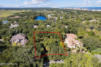
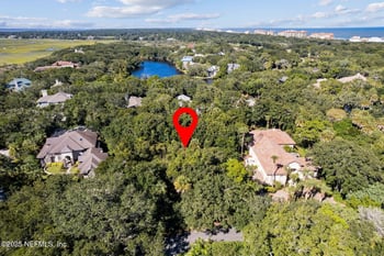
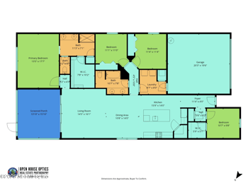

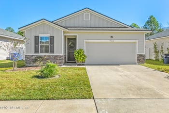


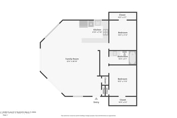
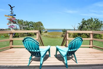
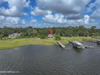
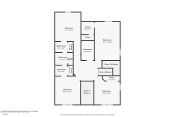



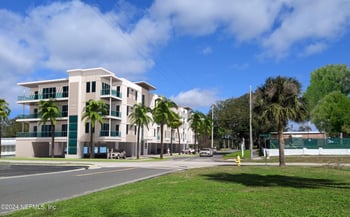
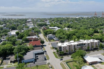
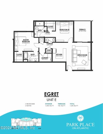
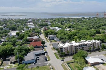
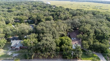
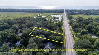
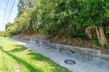
The practical answers depend on where the home sits, which public entrance or road you use, and what the district or property records say about that address.
Centre Street itself is convenient to explore on foot, but that does not mean every island home is walkable to downtown. A nearby home may make dinner, shops and the Amelia River waterfront a walk; another may require a drive and a place to park. Check the actual route from the front door, including crossings and what you would carry. Atlantic beach access is a separate trip from downtown.
As of October 26, 2026, downtown paid parking remains in effect, but the City has announced November 18, 2026 as its final day. Under the current program, non-permit parking costs $2 per hour plus fees and tax, with the first 20 minutes free each day and additional permit-based allowances. Check the City parking page for the transition and later rules. Even without a charge, space availability and the distance from a legal space to your destination still matter.
Start with the entrance you would actually use. The City lists Main Beach, North Beach and Seaside parks, plus smaller street entries; some have parking and others do not. At Main Beach, a Mobi-Mat is matting by the boardwalk ramp that helps wheelchairs, strollers and walkers move onto the sand; it does not make every stretch of beach accessible. Beach wheelchairs can be reserved through the Atlantic Recreation Center, subject to availability and service conditions. County facilities such as Peters Point and Burney Park follow separate rules. Test the approach with your usual gear or mobility needs on a weekday and a weekend, when parking may differ.
A walk or beach stop can fit a weekday if travel time and daylight allow; a fort tour has a tighter window. Fort Clinch State Park is posted open from 8 a.m. to sunset, while the fort is open 9 a.m. to 5 p.m. and the visitor center closes at 4:30 p.m. Park entry costs money, with an additional fort admission. Check current hours and fees against your real departure time rather than assuming a nearby address makes every activity feasible after work.
Many trips use SR 200/A1A west toward I-95 at Exit 373. A1A also runs south across Nassau Sound and the Talbot Islands toward Heckscher Drive and connections to I-295. The St. Johns River Ferry is a separate crossing between Fort George Island and Mayport farther south, not a ferry from Amelia Island. Your best route depends on the starting address, whether you need JAX airport, the Northside, Downtown or the Southside, and the hour; if considering the ferry, check its operating schedule. Test both commute directions, and use FL511 for current road conditions, not guaranteed travel times.
Zoned school assignment follows the residence. The district’s attendance-zone document, approved February 10, 2022, shows zone geography but cannot confirm school assignments for your intended year. Ask the district to verify the elementary, middle and high schools assigned to the exact address. Controlled Open Enrollment is a separate application process subject to school capacity, eligibility and possible lottery; the 2026–27 plan does not provide transportation outside the resident zone. Check the district plan and your pickup schedule.
Get property-specific homeowners and flood insurance guidance, including wind/hurricane deductibles, and inspect roof, systems and other maintenance obligations. Flood zones, evacuation zones and insurance coverage answer different questions. Estimate post-purchase property taxes rather than using the seller’s bill. Review HOA dues, assessments and restrictions if applicable; for a City historic-district property, verify exterior-work review before planning changes. If you intend to rent, confirm lawful use and permissions for that exact property.