HomeBlog Home
Fleming Island
Julington Creek

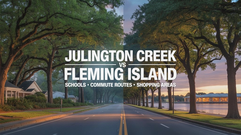
Julington Creek vs Fleming Island: Schools, Commute Routes, and Shopping Areas

Susie TakaraSusie Takara
Feb 22, 2026 • 10 min read
Share to X
Share to Facebook
Share to Linkedin
Copy Link
Julington Creek vs Fleming Island: Schools, Commute Routes, and Shopping Areas
Neighborhood Comparison

Julington Creek vs Fleming Island:
Schools, Commute Routes, and Shopping Areas

Picture two homes that look similarly convenient on a map: one near Race Track Road, the other near U.S. 17. Both have grocery shopping nearby. Then consider the trip to work, the schools serving each address and what the neighborhood charges for its amenities. That is where a comparison of Julington Creek and Fleming Island becomes useful. Neither area has a single answer for every buyer.

First, the names need boundaries. Julington Creek here means the Fruit Cove/northwest St. Johns County area, not just Julington Creek Plantation; some listings also use that name for Jacksonville/Duval addresses. Fleming Island means the wider Clay County area around U.S. 17 and CR 220, not only Fleming Island Plantation. Check the county and parcel before assuming a school district or community membership. For a closer look at either place, see Living in Julington Creek and Living in Fleming Island.

01
At a glance

First look: what changes between the two areas

Julington Creek starting points
  • SR-13 and Race Track Road lead to different grocery and highway approaches; see which one serves the home you are considering.
  • For a Southside job, compare the applicable SR-13/I-295 and Race Track/Peyton Parkway/SR-9B/I-95 connections from your street.
  • Alpine Groves Park is on SR-13, while Julington–Durbin Preserve trail parking is on the Jacksonville side off Bartram Park Boulevard.
Fleming Island starting points
  • Shopping is split between U.S. 17 and the CR 220 centers; the most convenient stop depends on the house, not the area name.
  • Doctors Lake Park is on Lakeshore Drive North; Black Creek Trail has several access points along the U.S. 17 corridor.
  • Your job destination matters: U.S. 17 can take you toward NAS Jacksonville without Buckman Bridge, while a Southside trip may cross it.
02
District zoning

Schools: address, grade and school year

Cross the county line and you change school districts. But even within a district, a listing’s neighborhood name cannot confirm the schools for a particular address. If that assignment matters to your purchase, start with your child’s grade and the year they will attend. Then ask a different set of questions: Is enrollment straightforward? Would you need a choice placement? Who handles transportation and after-school care? The zone lookup does not answer all of them.

Start with the district tools
  • Julington Creek, when the property is in St. Johns County: the district zoning page links its 2026–27 Attendance Zone Locator and a separate eighth-grade lookup for certain new K–7 opening-year zones. That exception does not apply to every eighth grader.
  • Fleming Island (Clay County): use Find Your School Zone and the district’s address lookup. Confirm the intended grade and year with the district rather than treating a listing’s school names as an assignment.
A dated screenshot is useful for comparing homes. It cannot guarantee next year’s boundaries, a transfer-school place, or a seat on a school bus.

Five school checks before you make an offer

1 Find the applicable assignment

Use the district’s current locator for the home’s county, intended year and grade. Save the dated result and ask about any unclear boundary.

2 Check each grade transition

Look at the applicable elementary, middle and high school boundaries, not an assumed permanent feeder path. For affected St. Johns eighth graders, check the separate opening-year locator.

3 Treat school choice separately

An address lookup is not a transfer approval. Clay’s controlled open enrollment depends on available capacity by school and grade and its application process; St. Johns school choice has its own conditions.

4 Verify buses and daily logistics

Clay lists separate 2026–27 bus registration and route resources. For Clay controlled open enrollment and St. Johns choice transfers, families arrange transportation. Ask about assigned-school eligibility, start times and care openings for your actual school and program.

5 Recheck before contracting

Before signing, rerun the lookup and ask the district about any grade, program or boundary exception you could not resolve. Do not rely on a school name copied from an older listing.

If the district line is only one part of a broader county decision, see Jacksonville vs Clay County vs St Johns County: How to Choose the Right Area. Once you know which school trip a home would require, add that stop to the drive to work.

03
Drive time reality

Commutes: Southside, Downtown and NAS Jacksonville are different trips

Change the destination and the road comparison changes. From Fleming Island, a trip to NAS Jacksonville can follow U.S. 17 north without crossing the St. Johns River. Change the destination to an office on the Southside, and I-295 over Buckman Bridge may become part of the drive. Downtown adds another distinction: the Northbank and Riverside are not the same approach as a Southbank address. Start with the actual workplace entrance, not just the word “Jacksonville.”

Julington Creek routes
  • From the Fruit Cove/Julington Creek Plantation side, SR-13 (San Jose Boulevard) and Race Track Road are distinct local approaches; the neighborhood entrance determines which you start with.
  • Race Track Road leads through Peyton Parkway toward SR-9B and I-95. SR-13 offers a different approach to I-295. CR 210 connects to I-95 farther south; it is not a direct I-295 entrance.
  • For NAS Jacksonville or another west-bank destination, an applicable SR-13/I-295 route may use Buckman Bridge. Check the actual gate or workplace, not a generic “Jacksonville” destination.
Fleming Island routes
  • U.S. 17 leads north through Orange Park toward Park Avenue/Roosevelt Boulevard; CR 220 connects west toward Blanding Boulevard (SR 21).
  • For NAS Jacksonville, U.S. 17 offers a west-bank approach without Buckman Bridge. Confirm the authorized gate and current base-access guidance.
  • For Southside, a U.S. 17/I-295 connection may cross Buckman Bridge. Downtown Northbank or Riverside can use U.S. 17 and suitable local/I-10 approaches instead; a Southbank endpoint is different.

What to look for on each route

  • The river crossing: if your route uses I-295 over Buckman Bridge, test both the morning and return trip. Do not assume a different line on the map is a practical backup from your particular address.
  • The first few roads: a turn onto SR-13 or Race Track Road, or access to U.S. 17/CR 220, can shape a trip even before the highway. Test any school stop on your actual route.
  • The destination: St. Johns Town Center in Jacksonville is not Fleming Island’s Town Center Boulevard; Downtown Northbank and Southbank entrances also differ.
Do this before you commit
  1. Use the actual home entrance and workplace or parking entrance. For NAS Jacksonville, check the gate you are authorized to use.
  2. Consult FL511 for traffic incidents, construction and current conditions, then test directions at your intended departure and return times.
  3. Repeat the test on another weekday, including school drop-off or other regular stops if they affect your trip.
  4. Check whether an alternate route actually reaches that entrance. Neither one live snapshot nor one test drive establishes typical travel time or reliability.

The same approach roads also affect where you stop for groceries and other errands. If your search extends farther into St. Johns County, see Nocatee vs Bartram Park vs Durbin: Commute Times, School Zones, and New Construction Reality.

04
Weekly logistics

Shopping and errands: which stops fit your drive?

A home can be close to shopping on a map and still send you out of your way for groceries. Around Julington Creek, Race Track Road and SR-13 lead to different store locations. On Fleming Island, there are stops along U.S. 17 and CR 220. The useful distinction is whether the places you actually use fall along a regular drive or call for a separate trip.

Try your regular stops: map groceries, a pharmacy and one recurring errand from each candidate home. Which can you combine with the drive to work or school, and which require a detour or separate trip? Check the actual roads and parking entrances rather than assuming that a nearby shopping center is a convenient stop.

Julington Creek errands
Fleming Island errands

If you are also comparing nearby communities, read Fleming Island vs Orange Park: Commute Routes, Schools, and Traffic. Shopping convenience is only one part of a home comparison. Next, check whether the property carries community dues, CDD assessments or separate recreation rights.

05
Fees & governance

HOAs and CDDs: fees, rules and access are not the same thing

Two homes in the same general area can come with very different recurring costs and amenity rights. A CDD is a special-purpose local government that levies district assessments; an HOA or POA is a separate private association with dues and rules. A home may fall under both. The district assessment does not explain the private restrictions, and seeing a pool or dock nearby does not establish an owner’s right to use it.

The Julington Creek Plantation CDD says its district covers most, not all, of that community and all of River Oaks Plantation; some older neighborhoods outside that district require a paid annual recreation membership for members-only amenities. On Fleming Island, Eagle Harbor, Pace Island and Fleming Island Plantation have different organizations and access arrangements.

The CDD boundary helps explain public assessments; HOA documents explain private dues and restrictions; amenity rules show who can use the facilities. Check all three for the address, not just the community name.

For a fuller explanation of the assessments and ownership tradeoffs, see What Are CDD Fees in Northeast Florida? (And When They’re Worth It).

Records to request for each address

  • HOA and subassociation documents: request current dues, budgets, rules and maintenance/insurance responsibilities. Check rental limits, parking, boats, pets and exterior changes against your needs.
  • CDD maps and assessments: verify the parcel’s district, current debt-service and operations/maintenance charges, and how they appear on the tax bill. Paying off district debt does not necessarily end operating charges.
  • Amenity rights and total carrying costs: confirm recreation membership, pool/dock or golf access separately. A tax-bill CDD charge already included in escrow should not be counted again.

Start with official Clay County or St. Johns County tax records, then obtain the actual association and district documents. The seller’s tax bill, exemptions and escrow do not establish your future total. For rule details, see the HOA verification guide.

06
Parks & outdoor life

Parks and trails: the entrance is part of the comparison

These public destinations offer different outings, from fishing piers and preserve trails to a paved path. Compare their actual entrances from a candidate home, rather than relying on the nearest map pin. Nearby private pools, docks or clubs have separate access rules.

Near Julington Creek: parks & preserves
  • Alpine Groves Park, 2060 SR-13, Switzerland, offers a riverfront fishing pier, pavilion, playground, picnic areas and an accessible trail: St. Johns County park information.
  • The Julington–Durbin Preserve offers nature trails and wildlife viewing, with public parking off Bartram Park Boulevard in Jacksonville. It is not a park inside the Julington Creek Plantation CDD: SJRWMD directions and preserve details.
Fleming Island: water & trails
  • Doctors Lake Park, 2399 Lakeshore Drive North, has a fishing pier and covered pavilion: Clay County park details.
  • Black Creek Park and Trail, 7890 Highway 17, includes an eight-mile paved trail along U.S. 17, with trailheads at Black Creek Park, Thunderbolt Park and Camp Chowenwaw County Park. Check which access suits your intended activity: Clay County trail details.
Before planning the trip
  1. Choose a candidate address and one park or trail entrance you would actually use.
  2. Check the agency’s facilities and any current access notices for your planned activity.
  3. Check the drive and parking approach at a time you would visit; do not assume access from the nearest map pin.
  4. If community recreation matters more than public parks, verify the property’s separate amenity eligibility and fees.
07
Decision framework

When two homes offer different tradeoffs

If your workplace is in Baymeadows or near St. Johns Town Center

Both destinations are on Jacksonville’s Southside, but an office in Baymeadows and one near St. Johns Town Center can require different exits and final approaches. Compare each home with your specific parking entrance and return trip, rather than assuming that one “Southside commute” describes them all.

If school pickup is part of the workday

A home-to-office route can look workable until a school stop changes the trip. Clay controlled open enrollment and St. Johns choice transfers place transportation on the parent or guardian, so compare the actual home-to-school-to-work sequence and the return pickup, not just the direct drive. Do not assume an optional placement or a bus arrangement is already secured.

If you are weighing future costs or resale

A lower asking price does not necessarily mean a lower cost of ownership. Compare documented HOA dues, CDD assessments, insurance expenses and property condition, and consider relevant comparable sales when thinking about resale. Neither an area name nor today’s school assignment predicts future appreciation, demand or zoning stability.

08
Your action list

Before you choose a house: the address-level checks

Once you have two homes you’re seriously considering, compare their exact addresses side by side. School zoning, property taxes, association obligations and even the turn onto the main road can differ despite similar neighborhood descriptions.

1
Schools

Check the intended school year and grade, then save the dated result. St. Johns: Attendance Zone Locator | Clay: Find Your School Zone. Confirm enrollment, school choice and transportation separately.

2
Commute

Test the exact home-to-work route at your real departure and return times; use FL511 for current traffic and incident conditions. A trial is not a promise of typical travel time.

3
HOA rules

Request governing documents and any subassociation rules, current dues and budgets, maintenance obligations and amenity policies. See the HOA guide.

4
CDD status

Check district maps and current property assessments, including debt and operations/maintenance charges. The Julington Creek Plantation CDD and Fleming Island Plantation CDD do not define either entire area.

5
Flood risk by address

Check the FEMA map and effective revisions against the building footprint, then ask about drainage, flood history and actual insurance terms. A zone label is not a no-flood promise or a premium quote. See the flood-zone guide.

6
Reported crime and jurisdiction

The Florida Department of Law Enforcement (FDLE) publishes Florida Incident-Based Reporting System (FIBRS) data from law-enforcement agencies. The visualizations contain production data those agencies submitted and verified from 2021 onward; that does not mean each underlying incident was independently verified. The offense dashboard covers Group A offenses—specified offense categories known to law enforcement—organized by incident date. Compare dates, offense definitions, agency coverage and jurisdiction before drawing conclusions. The Clay Sheriff and St. Johns Sheriff are local starting points; a Duval address falls under a different jurisdiction. These data cannot establish whether a particular street or home is safe.

7
Errands

Map the stores and recurring stops from the specific home, including their actual parking and road entrances. A center on the same corridor is not automatically the closest.

8
Weekend fit

Map the public entrance for your preferred park or trail and check its facilities. Verify private pool, dock or recreation rights from the community documents, not the area name.
FAQ: Julington Creek vs Fleming Island

How do I confirm which schools a specific house is zoned for?

Use the applicable district locator for the home’s actual county, intended grade and school year: St. Johns County’s Attendance Zone Locator or Clay County’s Find Your School Zone. St. Johns has a separate eighth-grade lookup for certain new K–7 opening-year zones. Confirm unclear results with the district; enrollment, school choice and bus eligibility are separate, and a saved result does not guarantee later boundaries.

Which side is easier for commuting to Southside, Downtown, or NAS Jax?

They are three different trips. Some Julington Creek-to-Southside routes use SR-13/I-295 or Race Track/Peyton/SR-9B/I-95; Fleming Island may use U.S. 17/I-295 and Buckman Bridge for Southside. For NAS Jacksonville, Fleming Island can take U.S. 17 north without Buckman, while a Julington Creek route may cross it. Downtown Northbank/Riverside and Southbank also have different approaches. Test the actual addresses and entrances; no area-wide time winner is established.

Which area feels more self-contained for errands?

Compare your own destinations from the home. On the Julington Creek side, Publix at Plantation Plaza on Race Track Road and Publix at Julington Village on SR-13 are different starting points. Fleming Island has grocery shopping on U.S. 17 and retail centers on CR 220, including Fleming Plaza. The nearest useful stop depends on the address and access roads; neither area is automatically more self-contained.
Are HOA rules and CDD fees common in both areas?

Both areas include properties with private association dues and some with separate CDD assessments, but neither label establishes a home’s charges. The Julington Creek Plantation CDD covers most, not all, of Julington Creek Plantation, and Fleming Island Plantation, Eagle Harbor and Pace Island have different arrangements. Check parcel boundaries, current tax assessments, association/subassociation documents and any separate recreation membership or amenity access.

What are a few easy weekend spots near each side?

Alpine Groves Park on SR-13 offers a riverfront pier and recreation areas; Julington–Durbin Preserve has public trail access off Bartram Park Boulevard on the Jacksonville side. Near Fleming Island, Doctors Lake Park on Lakeshore Drive North has a pier, while the eight-mile paved Black Creek Trail has multiple trailheads along U.S. 17. Check the specific public entrance and facilities before treating any as a quick stop.
If I only do one thing before choosing, what should it be?

Compare two actual addresses side by side rather than judging the area names. For each, confirm school zoning for the intended grade and year, trace the commute and check documented HOA/CDD costs and rules. Then compare flood information, insurance and the stores or parks you would use. It is one property-by-property exercise that can reveal important differences without promising to remove every risk.

View Fleming Island and Julington Creek Homes for Sale

512 Properties Found
Sort By:
WRITTEN BY
Susie Takara
Susie Takara
REALTOR

Susie Takara is a Northeast Florida REALTOR with United Real Estate Gallery. Agent license #3286939. She helps buyers and sellers around Orange Park, Clay County, St. Johns County, Jacksonville, and the larger Northeast Florida market compare homes, areas, and next steps with calm local guidance.

Related Properties

Get Your Home’s Real Value — Verified by a Local Expert
Have a top local Realtor give you a FREE Comparative Market Analysis
Home904 on FacebookHome904 on Youtube
Get in touch

Susie Takara, REALTOR®

(904) 595-9249

United Real Estate Gallery

1832 Park Avenue
Orange Park, FL 32073
Send us a message