$728,000
Active Under Contract
5
Beds
4
Baths
3260
Sqft
0.3
Acres
1874 Hickory Trace Dr, Fleming Island, FL 32003
MLS#: 2142091
_0001.jpg)
If you’re looking at Fleming Island real estate, the question usually isn’t “Is the area growing?” You already know it is. The real question is what growth and roadwork might change about your normal week: the school run, the Publix loop, the after-work drive home on US-17, and the errands that stop feeling quick when a lane shift hits at the wrong time. This guide stays out of the pro/anti debate and focuses on what’s checkable by address, so you can make a confident decision without guessing. If something can’t be confirmed by a map, a posted project update, or an on-the-ground drive, this page treats it as a verify-it item, not a fact.
“In Fleming Island, growth shows up in the small stuff first—school runs, the timing of US-17, and whether your ‘quick errand’ stays quick. The smartest move is to test your real routes and verify by address before you commit.”
— Susie Takara, Fleming Island real estate expert
This is for homebuyers who want Fleming Island for the day-to-day fit: established neighborhoods, convenience shopping, and a short list of main routes that you learn quickly. It’s also for anyone cross-shopping Orange Park or Middleburg and trying to choose the right Fleming Island real estate setup for their routine. If you want the broader day-to-day picture first, start with Living in Fleming Island: Daily Life, Schools, and the Drive-Time Trade-Off.
What this is not: a news recap, a political take, or a promise that any road project will fix traffic overnight. Think of it as a buyer-protective verification plan: where the changes are, how they can affect routine trips, and what you should confirm before you commit to a specific address.
Fleming Island is not hard to navigate, but it’s sensitive to disruption because daily errands and school runs repeatedly touch the same intersections and signals. Once you drive it a few times, you can feel where time gets spent: the US-17 and CR-220 approaches, and the Fleming Island Town Center shopping area signals when you’re doing back-to-back errands.
For most households, US-17 and CR-220 are the backbone routes. They’re how you get to the bigger Orange Park services, how you connect toward Jacksonville, and how you bounce between neighborhoods and the Fleming Island shopping nodes. When one piece slows down, the ripple is real: school pickup timing, after-work groceries, even the decision to go out to dinner can shift based on how the intersection is behaving that day.
Most homebuyers aren’t driving “to Fleming Island.” They’re driving from a Fleming Island address to a specific destination: Orange Park shopping and medical offices, job sites closer to Jacksonville, NAS Jax, or a daily run that depends on connecting into I-295. If you know your destination, you can predict your friction points: US-17 signals, CR-220 work zones, and the Town Center stop-and-go pattern.
The Fleming Island Town Center shopping area works because it’s convenient. It’s also where small disruptions can feel bigger than you’d expect. If you’re touring homes, pay attention to how often your likely routine crosses the Town Center connections and how many signal stops you stack on a normal loop. When road crews are resurfacing or shifting lanes, those small stops can become the thing that changes your weeknight timing.
A lot of the projects in and around Fleming Island are not mysterious. The county and FDOT publish project pages, updates, and meeting notes. The trick for homebuyers is translating that into “What happens to my Tuesday?” and “Does this matter for my street?”
Here’s the fastest way to check an address without getting lost: start with Clay County’s road updates and search for CR-220 segments that match your route, then open the NFLRoads US-17 project page and confirm the posted project limits. After that, use ClayView (the county GIS) to pin the home and trace your real turns to US-17, CR-220, Town Center, and any connector alignment. If the home sits within a few turns of a work zone, run your test drive at the same time of day you’ll actually live it.
Clay County’s infrastructure updates call out active CR-220 work, including the widening segment from Knight Box Road to Hollars Place, and related activity near intersections such as Henley Road and Joe Johns Road. Even if the work is not directly in front of the home you’re buying, it can change how you choose your routes and which turns become a hassle during peak times.
Buyer tip: don’t just look at a map and say “I’m not on CR-220.” Ask yourself how often you need to cross it, merge onto it, or use it to get to US-17. That’s where the friction shows up in real life.
The county has published lane-closure heads-ups for resurfacing work along CR-220 and Town Center Boulevard, including notes about nighttime single-lane closures. Night work sounds harmless until you realize it’s also when a lot of people run errands after work, pick up from activities, or try to do a quick loop before heading home. If your routine depends on that stretch, your weekday drive-time reality can shift for a few weeks.
FDOT/NFLRoads lists a US-17 resurfacing project in the Fleming Island area with defined limits (including Water Oak Lane to Eagle Harbor Parkway) and notes about intersection improvements. These kinds of projects are usually good long-term, but in the short term they can bring lane shifts, turn-lane changes, and occasional pattern changes that can surprise people who drive the same way every day.
Homebuyer move: during tours, drive the exact turns you’ll use at school-run time and again at 5:00–6:00 pm. If the intersection behavior feels stressful now, don’t assume it will feel calmer just because a project exists.
New connector roads matter to homebuyers because they can change where through-traffic shows up. If a home sits within a few turns of a new connection, it’s worth checking whether your street stays a destination street or becomes a pass-through during peak hours.
Clay County has a project described as a Radar Road extension to a Town Center Boulevard roundabout, with public meeting info hosted at the Fleming Island Library (1895 Town Center Boulevard). The practical takeaway for homebuyers is simple: a new connection can change how people cut through to avoid delays on a main route, especially when US-17 and CR-220 are busy.
For homebuyers, proposed development only matters when it changes the daily experience around an address: construction staging near your entrances, new access points that shift turning traffic, or added demand at intersections you rely on. The practical way to evaluate any proposal is to stay concrete: where it sits, where vehicles enter and exit, and what routes construction traffic would likely use.
The same logic applies to expanding retail: what matters is where new entrances land and which intersection gets the turning traffic.
Old Hard Road shows up in county agenda materials and local coverage as an area where proposals have been discussed. The buyer-relevant reason to mention it here is that it’s a clean example of how to evaluate buffer decisions. If you’re touring homes near a proposed site, the question is not “Will this happen?” The question is “If something moves forward here, what does it do to my routes and my immediate surroundings?”
If the home is close enough that you’d notice construction traffic, confirm how you’d enter and exit the neighborhood during staging, and whether your most common turns depend on intersections likely to see more demand.
Fleming Island is a school-driven search for a lot of homebuyers, and it’s exactly where people get tripped up by assumptions. Neighborhood names and marketing blurbs are not school assignments. Even “Fleming Island” as a label can hide boundary lines and rezoning conversations.
Clay County District Schools provides an address-based school zone tool and maps. Use it every time, for every address, even if a listing claims a school. Take screenshots for your records and keep them with your offer notes. If you’re comparing multiple homes, treat the school-zone result as part of your decision file, not an afterthought.
Helpful links: Find Your School Zone (Clay County District Schools) | School Rezoning (Clay County District Schools)
When a home is near a work zone, a connector alignment, or a growing retail node, the impact usually shows up in three places you can observe: noise during certain hours, turning movements at nearby intersections, and cut-through traffic on streets that connect back to the main routes.
At certain intersections, you can observe predictable driver behavior during peak times: late merges, rushed turns, and light-cycle stacking. You don’t have to treat that like folklore. You can test it. Spend ten minutes watching the turn patterns at the time you’d normally be driving, and decide whether it fits your comfort level.
This is the part that protects your decision. Fleming Island addresses can look similar on a map but live differently depending on which route you rely on (US-17 vs CR-220), how close you are to Town Center signals, and whether a connector or work zone sits within your normal errand loop. Use this checklist early so you’re choosing the address for your real routine, not the listing description. This is the same due diligence that keeps a Fleming Island real estate decision from turning into a daily frustration.
Helpful links: Clay County Infrastructure & Road Projects | FDOT/NFLRoads US-17 Project Details (Fleming Island area)
Helpful link: Radar Road Extension to Town Center Blvd Roundabout (Clay County)
Clay County’s GIS viewer is useful for getting grounded fast: parcels, nearby roads, water features, and the shape of development around an address. This is where you can stop relying on vibes and start relying on what’s actually around the home.
Helpful link: Clay County GIS Map Viewer
This is not about fear. It’s about avoiding surprises that affect daily life: parking rules, exterior changes, rental restrictions, maintenance responsibilities, and how the community handles common-area upkeep. Ask for the documents early. If something matters to you (boats, work trucks, fencing, short-term rentals, exterior paint rules), confirm it in writing. If you want the checklist version you can reuse across neighborhoods, see HOA Rules in Northeast Florida: What Homebuyers Should Verify Before You Buy. If you’re evaluating newer communities or newer infrastructure, it can also help to understand CDD fees in Northeast Florida and when they show up.
Even outside mapped flood zones, water behavior can be real on certain streets after heavy rain. Homebuyers do best when they treat drainage like a simple field check, not a vague fear. During a tour, look for clues that water wants to go somewhere it shouldn’t. If you want the by-address map checks and terminology in one place, use Flood Zones in Northeast Florida: How to Check a Property and What It Means. If you’re near a corridor with active roadwork or recent resurfacing, pay extra attention to where street runoff goes after heavy rain, because curb lines, ditches, and drainage paths can be part of what changes during construction.
These questions keep the conversation specific and document-driven, instead of relying on guesswork.
If you want a practical way to reduce risk fast, do this. It’s simple. It’s not perfect. But it catches the stuff that surprises people after closing.
This section is only here because route choice is the deciding factor for many Fleming Island homebuyers.
Fleming Island homebuyers often cross-shop Orange Park and Middleburg for similar reasons: schools, routines, and a drive that feels manageable. If you want the direct, side-by-side version of that decision, these two are the most relevant: Fleming Island vs Orange Park: Commute Routes, Schools, and Traffic and Middleburg vs Fleming Island: Commute Routes, Schools, and Daily Errands.
If resale matters to you, treat route friction as a marketability factor you can test now. Homes that require a stressful left turn, sit near a stacking intersection, or turn into a cut-through during peak times can be harder to tour and harder to enjoy. You don’t need to predict the market to protect yourself; you just need to confirm whether the address stays easy to live with.
If you want a short list that keeps you grounded, use this. It’s address-level, not opinion-level.
If you go under contract, set a simple monitoring habit: check Clay County’s road updates once a week, and re-check OneClay school zoning before your inspection period ends and again before closing if schools are a deciding factor. This keeps surprises from landing after your contingency windows close.
Fleming Island can be a great day-to-day setup when the routes match your routine and the address fits how you actually move through the week. Do the checks above, and you’ll know whether you’re buying into convenience or buying into avoidable friction.


Use the Clay County District Schools address-based school zone finder, then save a screenshot for your records. Do this for every address you tour, even if a listing claims a school, and scan rezoning updates if schools are central to your decision. Start here: Find Your School Zone.
Check Clay County’s infrastructure and road project updates for CR-220 and local resurfacing notices, and use FDOT/NFLRoads for US-17 project limits and status. Then drop the address into the Clay County GIS viewer to understand proximity to the segment and your real turns. Useful starting points: Clay County Infrastructure and NFLRoads US-17 Project Details.
“Too close” usually means you can feel it in your daily turns: queue spillover at your entrance, noise from braking and acceleration, or you’re within a few turns of a staging or detour pattern. The safest method is a time-of-day test: run your exact school-run and weeknight errand loop from the address, then repeat once on a weekend. If it already feels like a hassle, don’t assume it will improve on its own.
Look for steady “connector” movement instead of destination traffic: cars flowing through without stopping at driveways, frequent U-turns, and drivers using the street to avoid a nearby light. Also watch the closest intersection for 10 minutes at peak time to see whether queues block neighborhood exits or push cars onto side streets.
Walk the lot and look for water behavior clues: grading that slopes toward the home, downspouts that dump near the foundation, ponding at street edges, and driveway or garage flow that would carry water toward doors. If you want the map steps and terminology in one place, use: Flood Zones in Northeast Florida: How to Check a Property and What It Means.
Request the declaration/CC&Rs, rules and regulations, recent meeting notes, the budget, and any violation or architectural review policies. Confirm any non-negotiables in writing (parking, boats, work vehicles, fences, exterior changes, rental rules). For a full buyer checklist, see: HOA Rules in Northeast Florida: What Homebuyers Should Verify Before You Buy.
Start by identifying the site location and proposed entrances, then look for official agenda items, project pages, or posted notices connected to that parcel or corridor. If you can’t tie it to an official update, treat it as possible but not confirmed and focus your decision on what you can observe today: current route friction, intersection behavior, and how close the address is to likely staging or access points.
Re-check school assignment by address before your inspection period ends, and again before closing if it’s a deal-breaker. Re-scan Clay County road updates and the US-17 project page for schedule changes that affect your primary routes. If HOA documents are still pending, push to receive them early enough that you can act within your contingency windows.
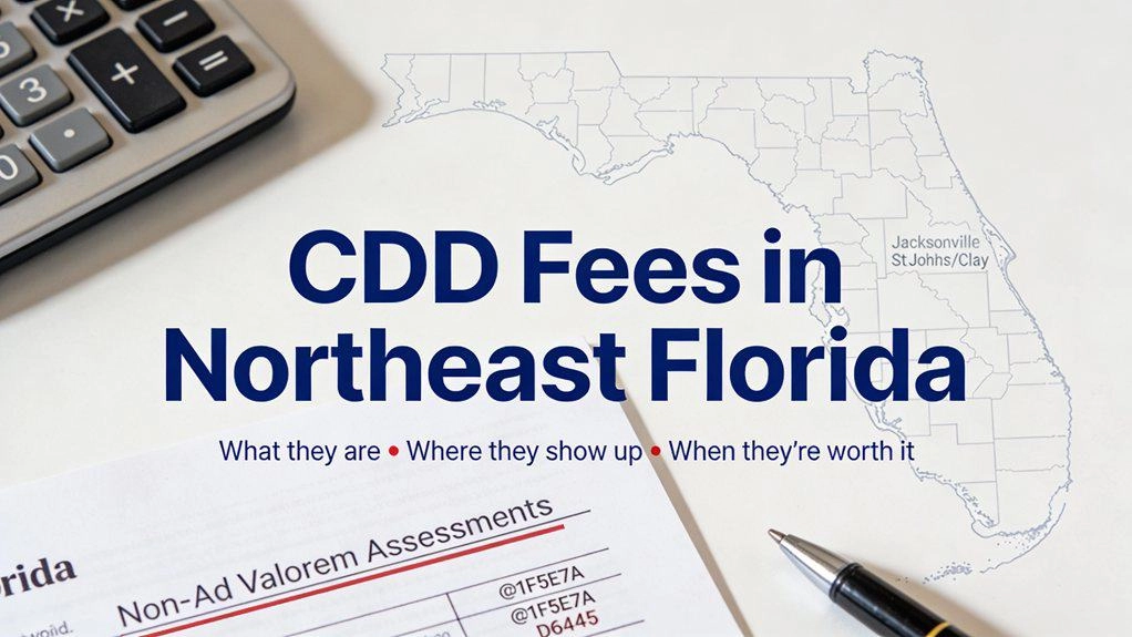
If you’re shopping newer, amenity-heavy communities in Northeast Florida, you’ll eventually see CDD show up in a listing, a lender worksheet, or a payment estimate—usually with zero context. And because it’s tied to the tax bill (not a normal “monthly fee” you can mentally file away), it tends to trigger the late-night spiral: Is this real? Does it go away? Am I about to get surprised later?This
Orange Park is the primary convenience hub for North Clay County, offering everything you need within a few miles—but that density means the main routes can get congested, so your daily timing matters more than the mileage.The “busy” feeling tends to show up along Blanding Blvd near Wells Rd—especially closer to the I-295 ramps—when everyone is running the same errands at once.It calms down quick
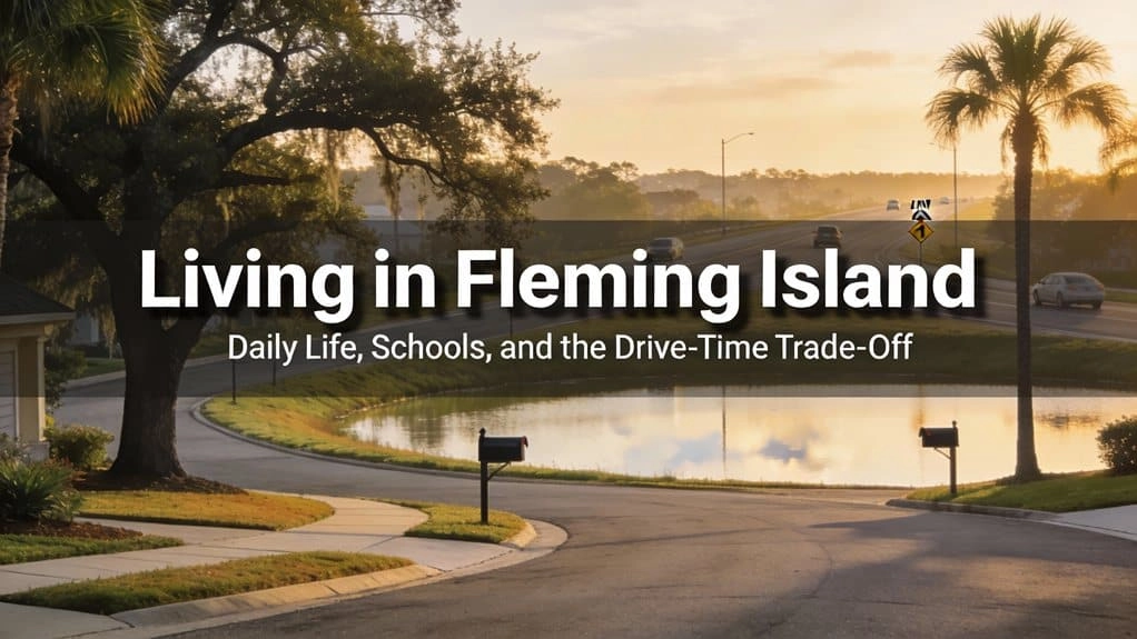
Fleming Island real estate appeals to buyers who want an everyday setup that feels organized: planned neighborhoods, quick errands around Town Center, and an easy reset near the water when the week gets busy. But it’s also a place where timing matters. The same drive on US-17 or CR-220 can feel effortless mid-morning and strangely heavy once school pickup and commuter traffic stack on top of each
If you’re shopping in Northeast Florida, “flood zone” comes up fast — usually right after you fall in love with a porch, a backyard, or a commute that finally feels doable. The tricky part is that water risk here isn’t one single thing. In some areas it’s rivers and creeks. In others it’s drainage and street ponding after summer storms. Near the coast, tide timing can change how quickly stormwate
If you’re cross-shopping Fleming Island and Orange Park, you’re not really debating “which one is nicer.” You’re choosing a weekday pattern: commute routes, school logistics, and where traffic reliably slows down. This comparison is written for homebuyers trying to pick the better day-to-day fit—without turning it into a rabbit hole.Both areas can make sense for real estate decisions in Clay Cou
When you’re buying a home in Northeast Florida, HOA rules are one of the fastest ways daily life can feel easy—or unexpectedly constrained. The smart move is verifying the rules by address, early, before you’re committed. Not because HOAs are “good” or “bad,” but because the details matter more than most people expect once real life shows up: guests, work vehicles, weekend projects, pets, and the
If you’re torn between Julington Creek (Fruit Cove / NW St. Johns County) and Fleming Island (Clay County), you’re not really choosing “a neighborhood.” You’re choosing a weekly routine: where school pickup stacks up, which way you cut toward work, and whether your “quick grocery run” stays quick.This is a lifestyle-first guide for your real estate search, built around things you can actually con
If you’re choosing between Middleburg and Fleming Island, you’re not really choosing between two dots on a map. You’re choosing a weekday routine. The difference shows up in the roads you end up driving without thinking, the errand hub you default to after work, and how predictable school assignments feel once you get down to a specific address.This isn’t about which place is “better.” It’s about


_0001.jpg)
_0003.jpg)

_0002.jpg)
_0001.jpg)