New - 19 Hours Ago
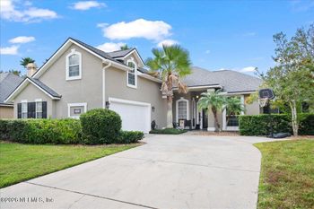
$545,000
Active
4
Beds
3
Baths
2647
Sqft
0.2
Acres
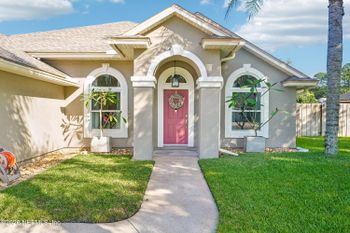
1820 Sea Pines Ln, Fleming Island, FL 32003
MLS#: 2173790


Two Fleming Island homes can look equally convenient on a map but make very different demands on a weekday. From one neighborhood, the trip toward Jacksonville might begin with an easy right turn. From another, the same trip might require a left turn across traffic before reaching U.S. 17. Add a school pickup or a stop near Town Center Boulevard, and the turns matter as much as the distance.
That is the useful way to look at Fleming Island real estate while roads and nearby development plans change. As of October 27, 2026, the County Road 220 bridge replacement over Little Black Creek is open, the Radar Road connection is under construction, and a separate Old Hard Road proposal is listed as a pre-application, not an approval to build. None of those statements, on its own, tells you what the drive from a particular house will be like. Here is what is documented and how to check what matters to your address.
U.S. 17 is the important north-south route for trips toward Orange Park, Jacksonville and connections toward I-295 or Naval Air Station (NAS) Jacksonville. County Road 220 (CR 220) carries a different set of east-west movements, while East West Parkway, Eagle Harbor Parkway and Town Center Boulevard bring their own turns and intersections into the picture. A route that works well for one destination may be awkward for another.
For example, a commute toward an Orange Park office can depend on a very different approach than a school pickup or an evening grocery run near the Fleming Island Town Center shopping area. Test both the outgoing trip and the return. A straight-line map measurement does not show whether a neighborhood entrance backs up, whether you need two signal cycles to turn, or whether your errands repeatedly take you across the same busy junction.
If you are still comparing the broader day-to-day tradeoffs, see Living in Fleming Island: Daily Life, Schools, and the Drive-Time Trade-Off. For road projects, the first distinction is even simpler: is the work finished, underway, or only proposed?
Radar Road is the project to watch around Town Center Boulevard. Clay County is building a two-lane connection between U.S. 17 and the existing Town Center Boulevard roundabout, with bike lanes, curbs, gutters and drainage improvements. Construction began April 6, 2026.
In its October 20, 2026 road-project update, the county anticipated paving the first phase by the end of November, followed by roughly one to two weeks of striping and final work. Phase 1 runs east from the Town Center Boulevard roundabout to the eastern entrance of the church parking lot. Phase 2 is planned to follow and continue toward U.S. 17.
The access change is important, but its timing matters. During the announced second phase, the Radar Road entrance at U.S. 17 will close and access will come from the Town Center Boulevard roundabout. The county says the first-phase roadway will be open, with both church parking-lot entrances and access to the library and nearby apartments available; the church’s semicircular driveway will not be accessible. The county describes those as upcoming Phase 2 access changes, not restrictions already in effect on October 27. Weather and other unforeseen conditions can shift the schedule.
If you are considering a home that relies on Town Center Boulevard, think beyond whether it is “near Radar Road.” Which approach will you use to reach the library, a nearby service, or U.S. 17? Would a temporary change require a different turn? For the proposed alignment as originally introduced, see the county’s February 2025 announcement and rendering; use the current project page, not that older announcement, for construction timing and access notices.
The CR 220 bridge replacement and four-lane widening project over Little Black Creek is no longer under construction. A September 25, 2026 News4JAX report says the project is complete and open to traffic. Work began in two phases: improvements around Rideout Ferry Road starting in December 2024, followed in January 2025 by the four-lane replacement over Little Black Creek.
That can matter if your route takes you west along CR 220 toward the Middleburg/Lakeside side of the corridor. It does not mean every project carrying the CR 220 name is complete, or that the CR 220/U.S. 17 intersection shares the bridge project’s status. The report describes expected improvement in flow and connectivity; it does not measure how many minutes any particular household now saves. Match the project limits to the part of CR 220 you actually drive.
Older notices also described resurfacing and nighttime restrictions on portions of CR 220 and Town Center Boulevard. Those were dated notices, not standing warnings about conditions today. Check Clay County’s current road-project updates and the date and limits of any posted closure before planning a route test.
The FDOT/NFLRoads description covers U.S. 17 from Water Oak Lane to Eagle Harbor Parkway. Its scope is more specific than a general promise to improve traffic:
If your commute uses the East West Parkway left turn, that is a different question from whether traffic backs up at Eagle Harbor Parkway. The listed construction scope explains what FDOT intended to change; it is not a before-and-after commute-time study, and an older project description alone does not establish an active closure today. Check current notices and drive the approach you will use rather than assuming a new lane guarantees a faster trip.
Road improvements are visible; development proposals can be harder to interpret. That matters near Old Hard Road, where an older denied rezoning and a later application record could easily be mistaken for the same project proceeding toward construction.
At the county’s July 8, 2025 hearing (item 15), officials reconsidered the requested rezoning for Fleming Island Preserve, PUD24-0006. The motion to deny that rezoning carried. The decision applies to that application. It does not mean another applicant or a separate proposal can never be considered.
The county’s public planning portal separately lists Partridge Preserve (Old Hard Road Subdivision), DEV_PLN1025-00109, with an application date of January 21, 2026. Its description reads “PRE-ApplicationPartridge Preserve - Live Local Act Development.” The system categorizes it as “New Commercial Development Plan” and shows the status “Fees Paid,” with preliminary review and meeting steps and no completion date. Those are the portal’s administrative labels. They do not establish a construction approval, an approved site entrance, or a start date.
To follow the later case, open the Partridge Preserve planning record or use Clay County Planning’s public-record instructions. The county says you can search public planning records without registering: choose planning records in the search menu and use the application name or number. Records from before January 9, 2023 have a separate entry point.
For a nearby home, the useful questions come next. Where does the site sit relative to your neighborhood entrance? Do the applicable submitted or approved plans show where vehicles would enter? Has the county issued a decision or permit since the record you reviewed? A proposed unit count or a headline cannot answer those questions, and neither an application nor a concern about added traffic proves a future cut-through route.
Start with ClayView, Clay County’s map viewer. Its Find menu includes “Find A Location By Parcel Information,” with a search box and Search button. The available layers include property lots, roads, zoning, future land use, flood zones and subdivision boundaries. Those can help you see whether the home opens onto a through street, where its main neighborhood entrance sits, and which intersections lie between that entrance and U.S. 17 or CR 220.
A road drawn on a map is not necessarily open, and a mapped connection does not establish an approved driveway. ClayView helps you see nearby roads and land use; it is not a property survey, a private-lot drainage inspection or a construction schedule. If a proposed road or subdivision entrance could affect your route, use the road authority’s current access notices and the applicable planning drawings rather than assuming the map shows what you can drive today.
You can learn more from three ordinary trips than from a single midday drive past the listing. Use the exact address as your starting point:
If you can safely observe from a permitted location, note whether left turns take multiple signals, where cars line up, and whether braking, truck movement, headlights or other noise are noticeable at the property. A ten-minute look is a useful snapshot, not proof of permanent traffic patterns or drivers’ intentions. Your experience on a route is not a promised travel time for anyone else, and future traffic from a road or development proposal remains uncertain.
Distance to a construction site is only one consideration. A home a little farther away may still depend on an entrance next to a work zone; a closer home on a street with limited through access may face a different issue. Ask the seller whether there have been notices about roadwork, staging, changes to turns or construction access. Ask the HOA or community manager whether it has received plans or notices affecting entrances, easements or common areas, and request copies when available.
The same questions are useful if resale matters to you. An awkward left turn, intersection noise or traffic near a driveway may influence how someone experiences a property, but that does not establish a future sale price or a measurable discount. Document what you can observe and what official plans actually show.
A road may be convenient for commuting yet inconvenient for a particular school pickup. Use the district’s current Find Your School Zone page and select “Click to Find My School Zone.” The linked tool lets you enter the address or choose a map location. Check the relevant school year, district rezoning information and boundary maps; save the result for your records. A listing label, nearby campus or neighborhood name does not confirm a school assignment, and bus transportation is a separate question for the district.
Roadway drainage improvements are not a guarantee about a private lot. At a showing, notice grading toward the house, the direction of downspouts, water marks near a garage, and low spots or ditches along the street. A dry-day visit cannot reveal every condition after heavy rain; ask the inspector targeted questions and review the Northeast Florida flood-zone and property-check guide when water is a concern. A home outside a mapped high-risk flood area can still have drainage or flood exposure.
HOA documents can clarify parking, boats, work vehicles, fences, exterior changes, rentals and maintenance obligations near an entrance or common area. Ask for the declaration, rules, recent meeting records and relevant notices early enough to review them. See the Northeast Florida HOA rules guide for the broader checklist. A Community Development District (CDD) is a special-purpose local government that can fund community infrastructure and ongoing upkeep through assessments. Those assessments are separate from private HOA rules and dues; check the property’s applicable district and tax records rather than assuming one charge explains the other.
For each home you are seriously considering, write down the details that could change your decision: the neighborhood exit, the turns on your essential routes, any road project along those routes, and the documented stage of a nearby development proposal. Check current county road updates and relevant FDOT project details. Temporary lane and access notices have dates and boundaries; an older notice should not be treated as a present closure. FDOT District Two also publishes a weekly road and lane report, typically on Fridays, for current construction restrictions.
If schools are central to the decision, keep the address lookup and review rezoning notices. Ask for seller and community road-access correspondence, and use project drawings if entrances or easements are in question. Check drainage observations against the inspection and the documents available for that home. Once under contract, recheck material status changes while your contractual review rights and deadlines still matter; those deadlines depend on your signed agreement, not a universal timeline.
Cross-shopping a different area? The useful comparison is not which place has fewer construction headlines, but how each address gets you where you need to go. See Fleming Island vs. Orange Park: Commute Routes, Schools, and Traffic or Middleburg vs. Fleming Island: Commute Routes, Schools, and Daily Errands if those are your alternatives.
The key distinction is between a change on a public road and a change in your own daily life. A new turn lane may help at the intersection you use; a completed bridge may sit outside your regular route; a proposed subdivision may have no approved entrance yet. Confirm what exists, check what is announced, and test the route that starts at the home.
The Property Search below shows homes listed with Fleming Island as the city, including Active, Pending and Coming Soon listings. Use it to find addresses worth exploring, then check the individual property and its routes. The search does not identify school assignments, exposure to road construction, or development approvals, and a listing shown here is not necessarily available to tour. Confirm its current status before making plans.




Open Clay County District Schools’ Find Your School Zone and select “Click to Find My School Zone.” Enter the exact address or use the map, confirm the relevant school year, and save the result. Check district rezoning information if attendance matters to your purchase. A listing’s school claim does not replace the district lookup; transportation eligibility is a separate question.
For dated county road and access notices, including Radar Road updates, use Clay County’s road-project page. The September 25, 2026 News4JAX report confirms the CR 220 bridge replacement over Little Black Creek is complete and open to traffic; other CR 220 projects may have different statuses. Use FDOT/NFLRoads for the U.S. 17 project’s limits and improvements. Compare relevant locations with the home using ClayView, then check the date and limits of any closure notice affecting your route.
There is no single distance that answers this. Check whether the home uses an entrance near a work zone, a busy signal or a planned connection, then review project drawings for documented access changes. Drive the school or work route at the hours you will use it, including the return trip, and listen for traffic noise at the property. A quiet visit cannot prove what a future road or development will do.
Start with the street layout: does it connect two busier roads, or does it end within the neighborhood? From a safe, permitted place, watch for queues that block the entrance, difficult turns and a steady flow of cars passing through at the times you would be coming and going. Repeat the observation at another hour if the route matters to you. Those observations describe current conditions; they do not establish why drivers use the street or predict traffic after a future road opens.
Check whether the ground slopes toward the house, where downspouts discharge, and whether driveways, garages, ditches or street edges show signs of standing or moving water. A roadway drainage project does not certify a private lot, and being outside a mapped high-risk flood area does not eliminate flooding or drainage concerns. Ask the inspector about the home and use the Northeast Florida flood-zone guide for map checks.
Ask for the recorded declaration of covenants, conditions and restrictions (CC&Rs) that applies to the home, plus applicable rules, the budget, recent meeting minutes, architectural guidelines and notices affecting common areas or entrances. Check the actual restrictions on parking, boats, work vehicles, fences, exterior changes and rentals; do not rely on a listing summary. The Northeast Florida HOA rules guide covers these documents in more detail. HOA obligations and Community Development District (CDD) assessments are separate matters.
Look up the application name or number in Clay County’s public planning records. Read the dated decisions, staff documents, submitted or approved plans and permits rather than relying on a proposal headline. For example, the 2025 denial of the Fleming Island Preserve rezoning is separate from the later Partridge Preserve pre-application record. An application marked “Fees Paid” is not an approval to build or proof of future traffic.
Recheck material road-access and construction notices for the routes you will use, and confirm the exact home’s school assignment and any relevant rezoning news. Review seller or HOA notices about entrances and construction, plus outstanding inspection or drainage questions. Get needed documents early enough to use the review rights in your signed contract; there is no universal inspection or contingency deadline.
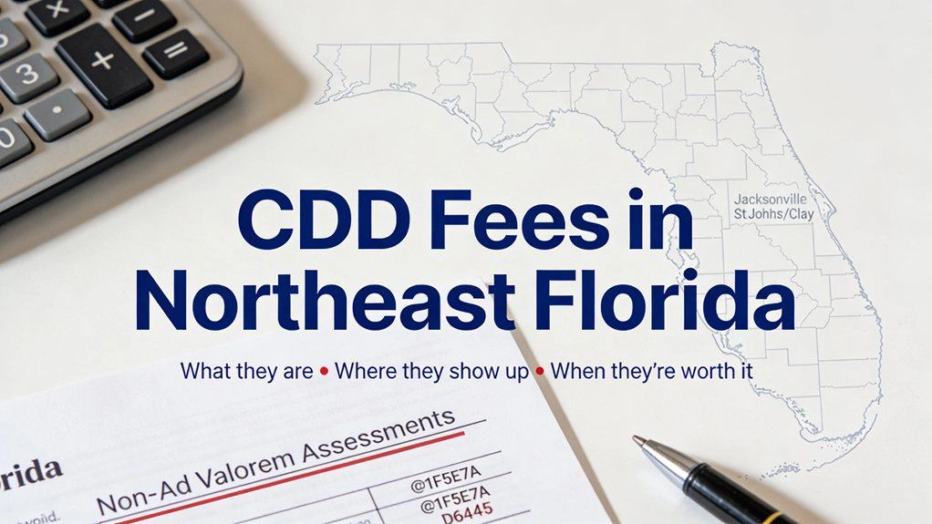
A CDD fee helps pay for a community's infrastructure and ongoing upkeep. In Northeast Florida, it commonly appears on the property's annual tax bill, separate from HOA dues. Paying off a home's CDD debt does not eliminate its ongoing maintenance assessment.The useful question isn't just, “Does this home have a CDD?” It's, “What will I owe for this address, what does that money cover, and is it al

An Orange Park mailing address or listing-city label does not necessarily put a home within the incorporated Town of Orange Park. The Town publishes a Town-limits map and street list; the roads and shopping areas discussed here extend beyond those municipal boundaries.Orange Park gives you access to shopping around Wells Road and Blanding Boulevard, established residential streets, and routes tow
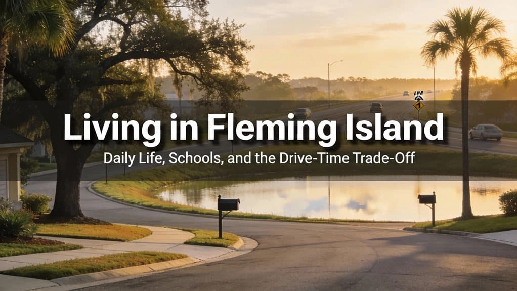
A Fleming Island home might put your grocery run near Town Center, a park by Doctors Lake within reach, and a neighborhood pool down the street. That sounds convenient until you need to make a left turn onto U.S. 17 at the same hour as commuters and school traffic. How well the home works for your weekday routine can matter more than the impression it makes during a weekend showing.One house may

If you’re shopping in Northeast Florida, “flood zone” often comes up after you’ve already noticed the porch, the backyard, or a commute that finally works. Then you see a flood-zone code on a map: AE, perhaps, or X. Neither one tells you whether water has reached the house before, whether the street drains after a summer storm, or what insurance might cost. Here, water can rise from rivers and cr
Updated October 25, 2026. Originally published February 15, 2026.If you’re cross-shopping Fleming Island and Orange Park, you’re not really debating “which one is nicer.” You’re comparing ordinary weekdays: the trip to work, a school stop if you have one, and whether a grocery stop sends you back through an intersection you had already cleared. The answer can change from one address to the next.
The house seems to fit. The driveway accommodates the work van, and the backyard has room for a fence. Then you open the HOA packet: parking restrictions, exterior approvals, and a rental rule you hadn’t considered. Here’s the Florida wrinkle: not every restriction printed in an HOA handbook is necessarily enforceable. Before buying in Northeast Florida, you need to know what applies to this part

Julington Creek vs Fleming Island: Schools, Commute Routes, and Shopping AreasPicture two homes that look similarly convenient on a map: one near Race Track Road, the other near U.S. 17. Both have grocery shopping nearby. Then consider the trip to work, the schools serving each address and what the neighborhood charges for its amenities. That is where a comparison of Julington Creek and Fleming I
Picture two possible Tuesdays. From a Fleming Island home near U.S. 17, you might drive north toward Naval Air Station Jacksonville (NAS Jax), the Navy installation on the west bank of the St. Johns River, and stop for groceries on the way back. From a Middleburg home off CR-218, reaching Blanding could be the first leg of that same routine. Neither example tells you which house is easier to live